Vintage Southwark Pictorial Map Print (1948)
Vintage Southwark Pictorial Map Print (1948)
Couldn't load pickup availability
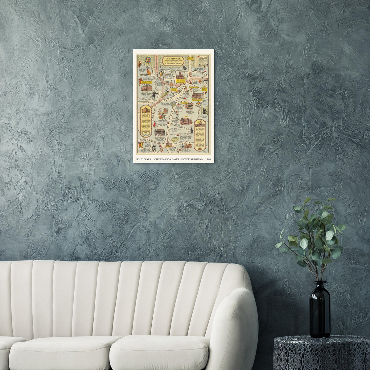
A Map of the Ancient Borough of Southwark was drawn by John Pearson Sayer for The Strand Magazine as part of its illustrated Survey of London series. The original was a small folded map, printed on both sides, with the principal map accompanied by cover artwork and a reverse page of “Memorabilia”.
Sayer follows Southwark from the Thames and London Bridge south towards Marshalsea Road, Tabard Street and Lant Street. Rather than presenting a conventional street survey, he uses the roads as a framework for the borough’s long history: Roman settlement, Saxon stronghold, medieval pilgrimage route and early-modern entertainment district.
The map gathers together many of Southwark’s defining places. The Globe Theatre and Bankside playhouses appear beside the Bear Garden; the Clink and Marshalsea prisons recall the borough’s harsher institutions; Borough Market, Guy’s Hospital, the George Inn and the priory church of St Mary Overy—later Southwark Cathedral—anchor the surrounding streets. Chaucer’s pilgrims, Dickensian references and small scenes of everyday life animate the route south from the river.
Its charm lies in Sayer’s combination of compact cartography and visual storytelling. Hand-lettered annotations, architectural vignettes, period figures, trains and red London transport symbols are arranged in a restrained palette of cream, blue, yellow, red and green. The result reads as both a map and an illustrated historical essay.
John Pearson Sayer (1901–1984) was a British artist, illustrator and graphic designer. He brought to these post-war magazine maps the pictographic style he had developed through earlier travel and railway work, turning local history into accessible, highly decorative printed maps.
As a historical work, some wording and claims reflect the sources and conventions of its period. They are retained as part of Sayer’s original artwork rather than presented as a current guide to Southwark.
Artwork: John Pearson Sayer · A Map of the Ancient Borough of Southwark · c. 1947–48 · produced for The Strand Magazine, London.
Archival records differ by a year: surviving examples are catalogued as 1947 or 1948. This reproduction follows the 1948 dating shown in the product title.
Research sources
Print details
Print details
Museum-quality matte fine-art poster. Heavyweight 250 gsm archival paper with a natural off-white, uncoated finish. Acid-free and FSC-certified. Printed to order and supplied unframed.
Frames and presentation
Frames and presentation
The artwork includes its designed ivory surround and caption. The relative width of the ivory surround may vary slightly between sizes so the original artwork keeps its correct proportions without stretching or arbitrary cropping. Frames and poster hangers are not included.
Delivery and returns
Delivery and returns
Each print is produced to order. Delivery times and the full returns information are available on our Delivery & Returns page.